
Shoreline Neighborhood Greenway Program
Proposed Amendments to the Transportation Element of Shoreline’s Comprehensive Plan, adding new policies to establish a Neighborhood Greenway (also known as “Healthy Streets”) Program.

Shoreline Neighborhood Greenway Program
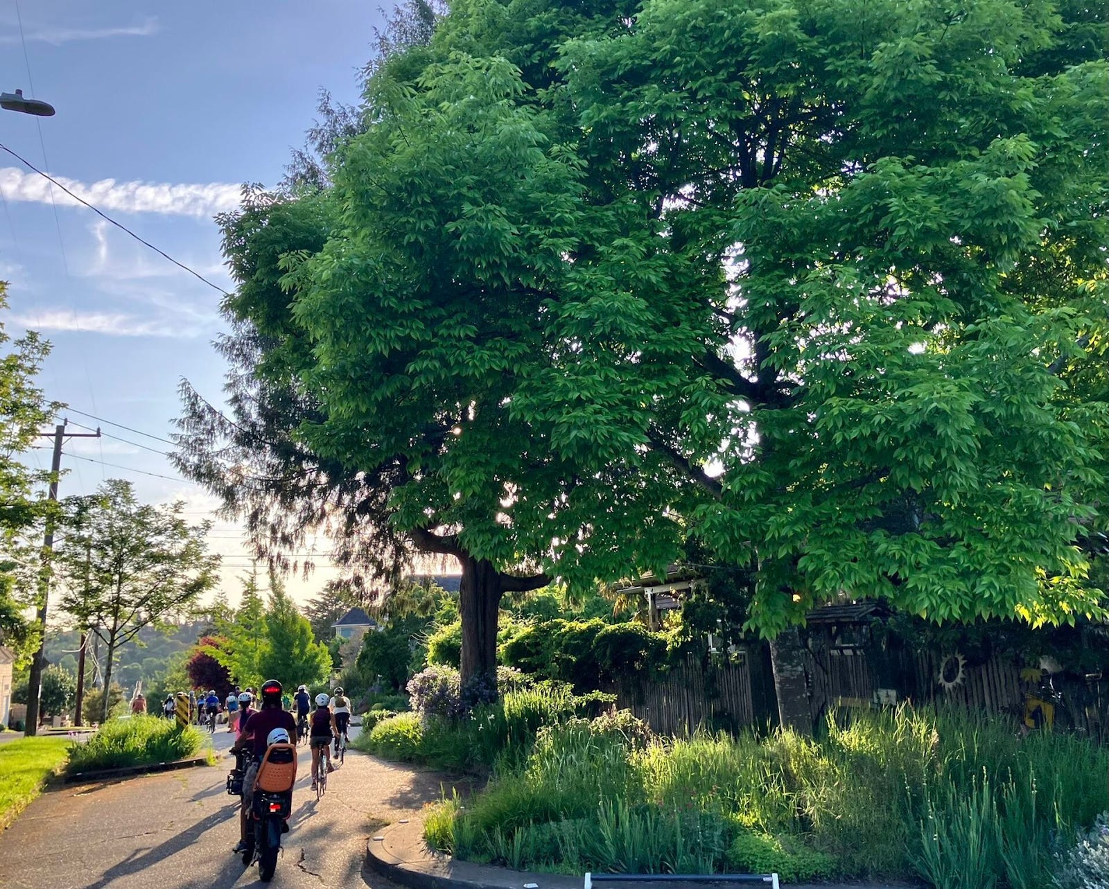
Shoreline is considering adopting our Comprehensive Plan amendment allowing the creation of Neighborhood Greenways. These Greenways would transform select residential streets into low-traffic, slow streets that connect neighborhoods and prioritize safe walking and biking.
Like all cities across the state, Shoreline must adopt transportation policies into its Comprehensive Plan. And each year, the city Planning Commission and City Council considers proposed amendments to the Comprehensive Plan. These policies direct city leadership and staff on priorities and goals. Urbanist Shoreline’s proposed amendment would add this policy to the Transportation Element of the Comprehensive Plan.
Proposed Amendments to the Transportation Element of Shoreline’s Comprehensive Plan, adding new policies to establish a Neighborhood Greenway (also known as “Healthy Streets”) Program.
Proposed General Amendment
Add New “Pedestrian System” Policy (Transportation Element Page 122-123 after T30):
NEW Policy T30.1: Establish a Neighborhood Greenway program using existing low-volume local streets to create safe, shared routes for pedestrians, cyclists, and local vehicle traffic. Using low-cost, quick-build traffic calming measures (such as diverters, speed humps, wayfinding signage, traffic calming, and landscaping features) to connect neighborhoods to schools, parks, transit, services, and places of employment. Shoreline’s Greenway Network will complement pedestrian and bicycle infrastructure on arterial routes.
Update “Bicycle System” Policies (Transportation Element Page 123):
T36: Design and construct all roadway improvements to be consistent with the future bike network vision and, when deemed safe and feasible, use short-term improvements, such as signage, Neighborhood Greenways, and markings, to identify routes when large capital improvements identified in the Bicycle Plan will not be constructed for several years.
Add clause to “Roadway System” Policy T55 (Transportation Element Page 125):
T55. Improve the street grid network to maximize multi-modal connectivity throughout the City and designating local streets as Neighborhood Greenways.
Add the underlined text to the Pedestrian Plan (Transportation Element Page 159)
Existing and future planned sidewalk can be viewed in Figure 13. The map indicates areas where sidewalk exists but does not specify if the sidewalk meets standards set forth in Policy T60.1 of this document. Shared-use paths, trails, Neighborhood Greenways, and facilities such as pedestrian lighting help to enhance the planned network Where shared-use paths, trails, or neighborhood greenways intersect an arterial street, a street crossing appropriate for the vehicle speeds, traffic volume, and other characteristics of the location should be provided.
Add the underlined text to the Bicycle Plan (Transportation Element Page 163):
It is important to provide bicycle facilities on a range of street types, including busy arterial streets, not just lower volume neighborhood streets. Bicyclists need to be able to connect to key destinations and commercial corridors which are often located along arterial streets. A successful modal network for bicycles will also consider how facilities are connected. When a bicycle facility along an arterial corridor or Neighborhood Greenway comes to an intersecting arterial, the corridor LOS and associated intersection treatments should be carried across the arterial. Otherwise, the arterial intersection may become a barrier to bicycle travel.
Add rows to Table 10: Project Ideas List (Transportation Element Page 175)
8th Ave NE from NE 148th St to NE 190th St - Neighborhood greenway connecting the Eastside Off-Corridor Bike Network, Shoreline South/148th Station, Paramount School Park, Ridgecrest Business District, Northcrest Park, Shoreline North/185th Station, and the northern Interurban/Burke-Gilman Connector.
Wallingford Ave N from N 150th St to N 200th St - Neighborhood greenway connecting the 145th Street Off-Corridor Bicycle Network, Twin Ponds Park, Evergreen School, Parkwood Elementary, Meridian Park, Meridian Park Elementary, Echo Lake Elementary, Aurora Village, and a future Interurban Trail SR 104 crossing.
NE Perkins Way from 15th Ave NE to Shoreline city limits - Neighborhood greenway restricted to local traffic to enhance safety and comfort of the existing Interurban/Burke-Gilman Connector.
27th Ave NE, NE 165th St, 22nd Ave NE, and NE 170th St from NE 140th St to 15th Ave NE - Neighborhood greenway connecting Seattle’s Olympic Hills Greenway, Briarcrest Elementary, Shorecrest High, Kellogg Middle School, Briarcrest Park, Hamlin Park, and the North City Business District.
Support for the Amendment
What are Neighborhood Greenways?
Neighborhood Greenways (also known as “Healthy Streets”) are local streets reconfigured to prioritize safety and active transportation. This amendment directs the city to start a Neighborhood Greenway program, turning existing local streets into safe, shared spaces for pedestrians, cyclists, and local vehicle traffic traveling at slow speeds. Instead of expensive land acquisition and road widening, the program deploys cost-effective infrastructure such as low speed limits, traffic diverters, speed humps, and signage to lower vehicle speeds while still allowing local traffic.
Who is proposing these amendments?
These amendments are proposed by Urbanist Shoreline, an informal community group advocating for a more liveable and equitable city.
Why Now?
Much has changed since Shoreline’s Transportation Element (TE) was adopted.
Transit Expansion: The 2024 opening of the Lynnwood Link Extension brought two light rail stations to Shoreline and more frequent local bus routes.
Population Growth: Shoreline’s population has grown significantly since the adoption of the TE, increasing density and demand for non-motorized transportation options.
Safety Crisis: Shoreline’s roads are more dangerous now compared to when the TE was adopted. Serious and fatal collisions on Shoreline’s roads reached record highs.
Financial Constraints: The city’s current transportation plans rely on capital-intensive infrastructure funded by grants and impact fees. Those funding sources are at risk of dwindling.
Rising Costs: Historic inflation has escalated construction costs, making investments in sidewalks and bike infrastructure more expensive.
Shared Streets Law: In 2025, Washington State enacted the new “Shared Streets Law” (SB 5595), a first-in-the-nation law that allows cities to designate non-arterial roads as shared spaces where pedestrians, bicyclists, and vehicles commingle, with pedestrians having priority.
Quick Build Guide: In 2025, WSDOT published the Quick Build Guide, providing practical information to cities on the Quick Build project process, design considerations, project types, community engagement, and real-world examples to help create safer spaces and promote traffic calming.
Common Adoption: Greenways and Healthy Streets are now common as cities near Shoreline have adopted similar programs. Neighboring cities including Seattle, Kirkland, Bellevue, Edmonds, and Lake Forest Park have adopted Greenway or Healthy Streets programs.
Benefits for Residents
Greenways deliver quality-of-life improvements for Shoreline residents.
Safety: Traffic calming measures like speed humps and diverters reduce vehicle speeds, improving safety and comfort for people walking and biking, especially for non-driving children and seniors.
Cost Efficiency: Greenways utilize existing city rights-of-way, avoiding expensive land acquisition. Implementation relies on low-cost, “Quick Build” engineering practices such as signage, paint, delineators, and planters.
Speed of Delivery: Unlike traditional capital projects that require years of design and construction, Greenways use rapid and reversible “Quick Build” practices.
Health: Greenways provide linear parks encouraging walking, biking, and safe outdoor play.
Consistency with Comprehensive Plan & Adopted Policies The proposed Neighborhood Greenways program is an implementation strategy that supports Shoreline’s existing goals across multiple adopted plans:
Safety & Vision Zero: The Transportation Element prioritizes “Target Zero” (Policy T23), vulnerable user safety (T25) and lowering vehicle speeds (Policy T33). Greenways directly address the City’s rising collision rates by using traffic calming to lower speeds, aligning with the “Safe Systems” approach.
Climate Action: The Climate Action Plan mandates reducing Vehicle Miles Traveled (VMT) to lower emissions (Policy T1). Greenways facilitate this mode shift by creating safe, low-stress routes for short trips and reducing car dependency.
Urban Forest: Greenways support the Urban Forest Strategic Plan goal of expanding tree canopy by incorporating street tree chicanes that physically calm traffic while creating new planting zones in the right-of-way. Greenways can also expand pedestrian and bicycle facilities without expanding the roadway and removing trees.
Parks & Recreation: The PROSA Plan envisions a connected system of recreation facilities. Greenways function as “linear parks,” expanding the City’s open space inventory and fulfilling the goal of equitable access (Policy PROSA 1.6) to recreation in every neighborhood. Greenways convert dangerous roads to public spaces where even children can safely play.
Land Use: The Comprehensive Plan calls for “well-connected neighborhoods” (Goal LU 1). Greenways provide the missing “first/last mile” infrastructure to connect residents to commercial centers (Policy ED 4.1) and new light rail stations (Policy LU 4.10).
Below are all the goals and policies in the Shoreline Comprehensive Plan that are aligned with a Greenway and Healthy Streets Program. (10 Goals, 36 Policies)
Goal LU 1 Establish land use patterns that accommodate growth and promote well-connected neighborhoods and accessibility to goods, services, multimodal transportation, and amenities.
Policy LU 1.2 Encourage land use patterns that provide opportunities to walk, bike, and use transit to access goods, services, education, employment, and recreation.
Policy LU 3.4 Continue to implement and further develop specific regulations to support active ground floor uses on appropriate streets and locations to promote vibrant pedestrian corridors.
Goal LU 4 Promote a mix of transit-supportive uses in high-capacity transit areas that will enhance livability and vibrancy to contribute to Shoreline’s social, environmental, and economical sustainability.
Policy LU 4.2 Coordinate with regional transit providers, neighborhood groups, business owners, and other diverse interests to identify additional design and amenity improvements that can be efficiently constructed in conjunction with high-capacity transit areas.
Policy LU 4.3 Plan for and increase transit-supportive land uses and densities that maximize benefits of transit investments in high-capacity transit areas.
Policy LU 4.4 Encourage mixed-use developments along transit corridors that create housing affordable to households of all sizes and incomes and are well connected to neighborhood centers with a range of transportation options.
Policy LU 4.5 Create strategies, in partnership with the neighborhoods adjoining high-capacity transit areas, for the transition to more compact and transit supportive land uses.
Policy LU 4.6 Encourage high-capacity transit areas to serve the greatest number of people traveling to, from, and within Shoreline, by promoting, where appropriate, residential densities with a mix of commercial and office uses, and multi-modal transportation facilities.
Policy LU 4.10 Design transit-oriented areas to include non-motorized corridors accessible to the public, providing frequent connectivity for bicyclists and pedestrians to key destinations and transit stations. These corridors should be connected with surrounding bicycle and sidewalk networks.
Policy LU 5.1 Educate the community about development concepts, policies, and practices that support sustainability, including incentives and programs supported by the City and its partners.
Policy H 3.5 Increase the availability of affordable housing throughout the city to reduce the risk of displacement, through incentives, strategies, and actions to foster equitable access to community resources such as parks, open spaces, safe pedestrian and bicycle networks, clean air, soil, water, healthy foods, high-quality education, affordable and high-quality transit, and jobs.
Goal H 4 Integrate new development and redevelopment with consideration to design and scale that promotes the city’s vision for its future as a sustainable, welcoming, walkable, and safe city, provides effective transitions between different uses and intensities, and mitigates the potential risks of displacement from redevelopment.
Policy H 9.2 Support greenhouse gas emission reduction efforts through transit-oriented development, increased density and walkability, and parking demand reduction in new housing development, particularly near transit.
Policy ED 4.1 Improve access to businesses and commercial services through the support of new connections within and between existing commercial districts, residential neighborhoods, and light rail station areas by enhancing the street grid, encouraging streets that connect parallel rights of way, improving pedestrian amenities and safety, and expanding east-west connections through the city’s existing trail network and future intra-city transit routes
Policy ED 4.3 Establish and enhance new and existing neighborhood commercial centers and corridors to support increased commercial activity, neighborhood identity, and access to daily goods and services by focusing investment into improved pedestrian and bicycle facilities, wayfinding, public plazas and green space, events and programming, and other desired community amenities.
Policy CD 1.5 Encourage commercial, mixed-use, and multi-family development to incorporate public amenities, such as public and pedestrian access, pedestrian-oriented building design, mid-block connections, public spaces, activities, and solar access.
Policy CD 1.17 Provide public and open spaces of various sizes and types throughout the community.
Goal CD 2 Design complete and connected streets with shade trees and vegetation, lighting, and continuous bike and pedestrian improvements that connect neighborhoods.
Policy PROSA 1.2 Provide a variety of indoor and outdoor gathering places for recreational and cultural activities.
Policy PROSA 1.6 Support a variety of multi-modal infrastructure options, such as trails, paths, and bikeways, that improve accessibility to resources in an equitable manner.
Policy PROSA 1.7 Improve accessibility and usability of existing facilities.
Policy PROSA 1.8 Explore opportunities to increase use of City facilities to meet community needs.
Policy PROSA 2.5 Adjust program and facility offerings to align with demographic trends, community feedback, and needs assessments.
Goal 4: Connectivity Complete a network of multimodal transportation connections to and from key destinations such as parks, schools, community services, commercial centers, places of employment, and transit.
T1. Work to reduce vehicle miles traveled (VMT) and transportation-related greenhouse gas emissions in line with the level needed to meet emission reduction goals in the Climate Action Plan.
T2. Reduce the impact of the City’s transportation system on the environment through expanded zero-emission vehicle use and active transportation options and identify opportunities to increase electric vehicle charging infrastructure when planning and designing transportation projects and facilities, on City rights-of-way or adjacent property(s), or through other transportation policies and programs.
T4. as well as evaluate, implement, and advocate for other parking management and transportation demand management strategies that support the goal of reducing VMT.
T23. In conjunction with the Washington State Target Zero Plan, prioritize transportation planning, design, improvement, and operational efforts with the goal of achieving zero serious or fatal injury collisions.
T25. Prioritize pedestrian, bicyclist, and other vulnerable user safety over vehicle capacity improvements.
T31. When identifying transportation improvements, prioritize construction of sidewalks, walkways, pedestrian crossings, and trails, including increasing the number of pedestrian-oriented connections and safe crossings that reduce barriers and make walking trips more direct.
T32. Utilize existing undeveloped right-of-way to create pedestrian paths and connections where feasible.
T33. Design and construct roadway improvements to be accessible by all, minimize pedestrian crossing distances, create convenient and safe crossing opportunities, reduce pedestrian exposure to vehicle traffic, and lower vehicle speeds.
T36. Design and construct all roadway improvements to be consistent with the future bike network vision and, when deemed safe and feasible, use short-term improvements, such as signage and markings, to identify routes when large capital improvements identified in the Bicycle Plan will not be constructed for several years.
T45. Continue to install and support the installation of transit-supportive infrastructure.
T51. Design City transportation facilities with a primary purpose of moving people and goods via multiple modes (component of Complete Streets3), including automobiles, freight trucks, transit, bicycles, and walking, with vehicle parking identified as a secondary use, and utilizing natural stormwater management techniques and landscaping (component of Green Streets) where appropriate.
T61.1. Establish the Bicycle Plan to connect major destinations, transit stops and stations, and residential, commercial/retail centers, and employment centers.
T64. Adopt a transportation concurrency program that advances construction of multimodal transportation facilities in Shoreline.
Policy SMP 2.1 Provide for public access to publicly owned shoreline areas, except where deemed inappropriate due to safety hazards, inherent security problems, conflicts with adjacent uses, or environmental impacts such as erosion or habitat impairment
Goal SMP 3 Develop public and private recreation opportunities that are compatible with adjacent uses and that protect the shoreline environments.
Policy SMP 3.1 Provide for the preservation and enlargement of public and private recreational opportunities and recreational facilities along the shoreline, including but not limited to, parks and recreational areas, wherever appropriate.
Goal SMP 4 Provide inter-connected, efficient, and safe transportation networks to and around the shoreline to accommodate vehicles, transit, pedestrians, and cyclists to improve public access.
Policy SMP 4.1 Provide for a safe and adequate circulation system, including existing and proposed major thoroughfares, transportation routes, terminals, and other public utilities and facilities within the shoreline jurisdiction that benefit permitted uses and public access to shoreline without degrading the environment or aesthetic values of the area.